
Tyne and Tides
A complete mile-by-mile route guide for runners and walkers
What to Expect: A run from working river to open sea. You leave a quiet nature reserve on an old railway line, drop to the Tyne, follow it past a Victorian custom house and a Roman fort to the lighthouse at its mouth, turn the corner onto the North Sea, run the limestone cliffs of The Leas, and climb home up the Great North Run’s most famous descent. All in under thirteen miles.
MILE 0 — 2.4: TILESHEDS | THE OLD RAILWAY TO THE RIVER
Start at the car park at Tilesheds Nature Reserve, named after the brick and tile works that once dug the natural clay here. The reserve itself is young: the pond, the marsh and the network of rolled-stone paths were created in the 1990s (South Tyneside Council). Leave the car park and head west along Tileshed Lane. A little over a quarter of a mile in, you pick up the old railway.
This is the same corridor that closes the Coast and Coal Loop: the disused line, now part of the National Cycle Network, that runs dead straight to Tyne Dock. Here you take it outbound. For a mile and a half the path barely changes height, holding at around 23m between its green margins. Note the turning on your right at mile 1.3. That is where you will rejoin on the way home.
At mile 1.8 the path ends and the town takes over. A short dog-leg on pavement brings you past Tyne Dock, and then the ground tips away: you drop 16m in the next half mile, the only sustained descent on the route. By mile 2.4 you are 5m above the water and the air smells different.
Runner’s Note This is the warm-up, and it is a long one. The railway path is the easiest running of the day, so resist the urge to bank time. The route earns its keep after mile 8.
MILE 2.4 — 5.2: THE WORKING RIVER | TYNE DOCK TO THE GROYNE
Follow Commercial Road north, running alongside the Port of Tyne. This is not a pretty mile and it is not meant to be. It is the river still earning its living, and it rolls more than you expect, cresting at 16m near mile 3.3 before dropping to the Mill Dam.
At mile 3.8 you reach the Customs House. Built in 1863 and 1864 to a design by T. M. Clemence, it opened in July 1864 to handle goods moving through Shields Harbour and reopened in November 1994 as an arts venue (Wikipedia). From here the route keeps to the water’s edge, past the ferry landing at mile 4, where the Shields Ferry crosses to the north bank.
Beyond the ferry the riverside narrows and quietens, then the road lifts you onto the Lawe Top at mile 4.7. Arbeia Roman Fort stands a short detour inland on Baring Street. Its name is thought to mean “place of the Arabs”, after a late garrison of Tigris boatmen (North East Museums), men who knew a very different river from this one.
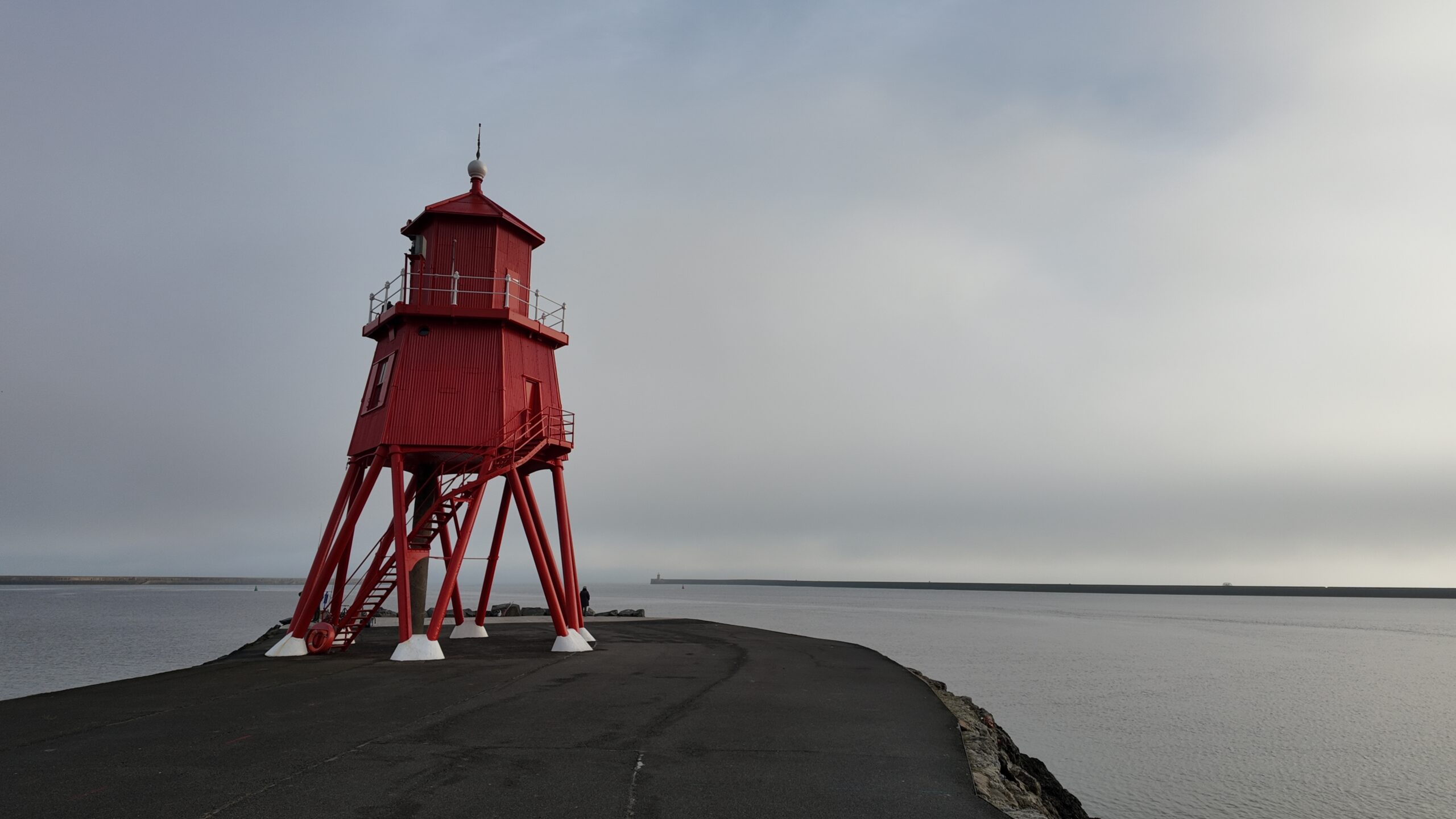
Drop off the Lawe and the estuary opens in front of you. At Littlehaven you take a deliberate out-and-back, about 150m each way, for a closer look at the Herd Groyne and its lighthouse. It was built in 1882, stands 13m high and still has a working fog bell (Fabulous North). Mile 5.2 is your turnaround: river on one side, open sea on the other.
Runner’s Note: Commercial Road is where this run feels longest, running alongside the Port of Tyne. This is not a pretty mile and it is not meant to be. It is the river still earning its living, and it rolls more than you expect, cresting at 16m near mile 3.3 before dropping to the Mill Dam.the effort honest over its rollers and let the Customs House pull you in. From the Mill Dam onwards the landmarks come every few minutes and the miles stop counting themselves.
MILE 5.2 — 8.6: LITTLEHAVEN TO MARSDEN | PROMENADE AND THE LEAS
MILE 5.2 — 8.6: LITTLEHAVEN TO MARSDEN | PROMENADE AND THE LEAS
Retrace the short out-and-back and follow the Littlehaven promenade. Almost at once you pass the Conversation Piece, 22 figures by the Spanish sculptor Juan Muñoz that locals call the weebles. The promenade then curves round to the foot of the South Pier at mile 5.9. The pier is not part of the route, but it is the hinge of the whole run: behind you the Tyne, ahead of you the North Sea. From here the Sandhaven promenade runs south-east for a mile, flat and fast at 5m above the beach. In summer you will be weaving through families and ice creams. In winter you may have it to yourself.
The promenade ends at Trow, by the Waters Edge pub at mile 6.9. A stone path takes over and climbs onto the cliffs, and you have left the town behind. Almost at once the route takes a deliberate spur out onto Trow Rocks, about 50m each way, for a closer look at one of the stranger relics of the coast: the concrete housing of a disappearing gun designed by Sir Hiram Maxim and first placed here in 1887, when the Army was experimenting with coastal defences. The gun in the pit today is a replica, installed in 1987 to mark the centenary (Shields Gazette).
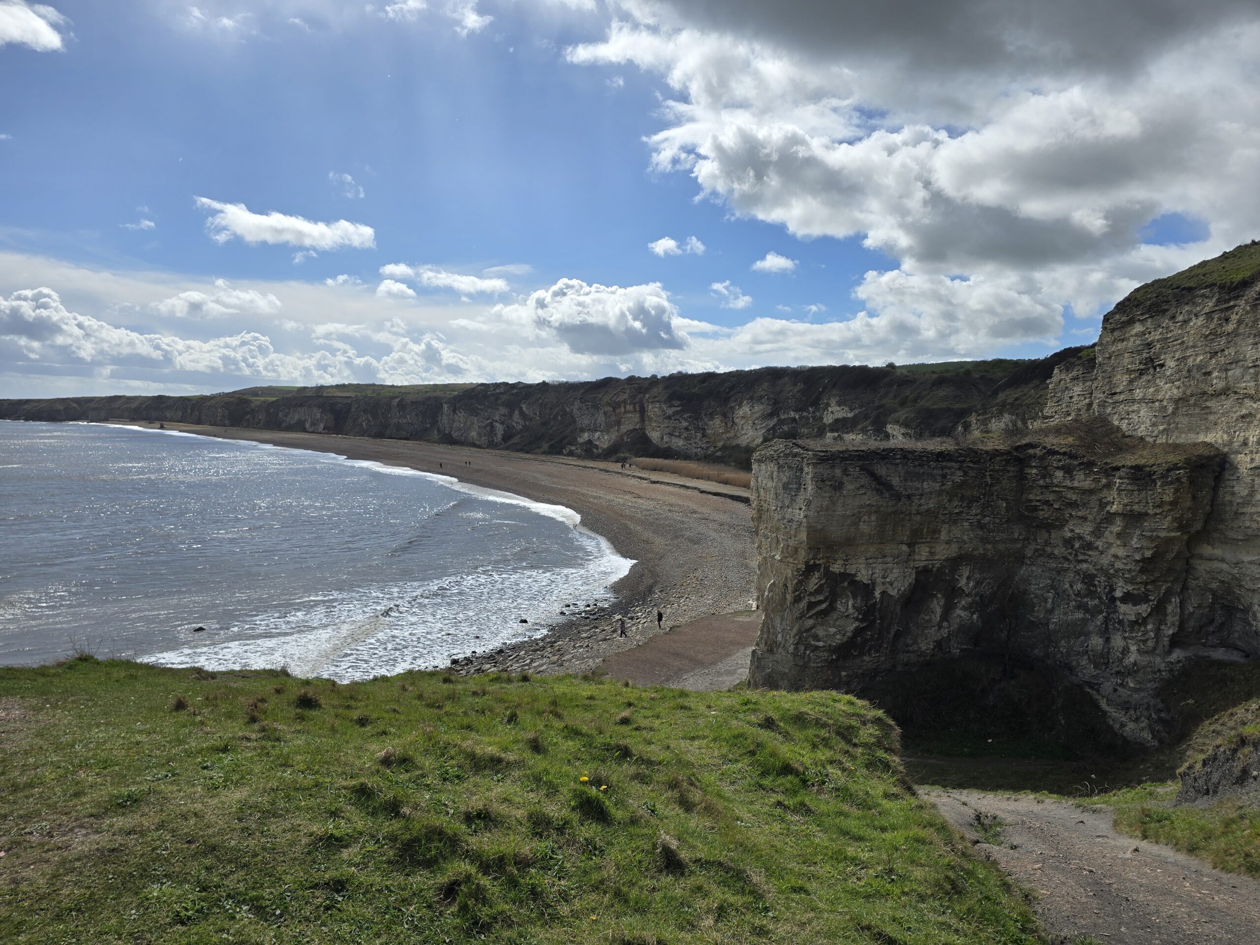
Now comes the best running on the route. From Trow the path rises from about 10m to 21m over half a mile and then follows the clifftop, with The Leas rolling away to your right and nothing but sea to your left. It dips to cross the head of Frenchman’s Bay at mile 7.7, rises, and dips again at Man Haven at mile 8.1. Hold your line on the path here rather than drifting towards the edge for the view. Marsden Sands appears below as you reach the Coast Road roundabout at mile 8.6.
Runner’s Note: If you have anything spare, Marsden Rock and the Grotto are about 700m further along the coast from the roundabout. More than 5,000 pairs of kittiwakes nest in Marsden Bay (National Trust), so it is worth the extra mile in spring and early summer.
MILE 8.6 — 12.8: REDWELL LANE | THE CLIMB HOME
Turn your back on the sea and pay for the view. Redwell Lane rises straight from the roundabout, gaining 14m in the 200m to the roundabout with Marsden Lane and Lizard Lane. The route’s 45m high point comes just beyond it, at mile 8.8.
Anyone who has run the Great North Run knows this hill from the other side. On race day Redwell Lane is the milestone every runner is waiting for: the long climb through South Shields ends here, and the field comes down “a steep drop of about 15 metres into the final mile” (NewcastleWorld) before swinging onto the Coast Road for the finish. Today you take it the wrong way, uphill, with eight and a half miles already in your legs.
From the top, Prince Edward Road carries you west for a mile on a long, barely perceptible descent. This is Great North Run ground too, and one of its hardest stretches: the rolling “Prince Edward bumps” of miles 11 and 12, where the half marathon climbs towards the sea on tired legs. You get the same road in reverse, with the gradient on your side. You pass the parade of shops at The Nook around mile 9.7 and reach the King George Road roundabout at mile 9.9, the last big landmark of the run.
The next mile and a half follows the John Reid Road corridor west, past South Tyneside District Hospital and Temple Memorial Park, then threads residential streets over one last small rise, to 30m at mile 11. Just after it, the route runs about 150m down the road to a crossing and doubles back along the far side. It looks like a detour on the map, but it is the safe way over. At mile 11.4 you are back on the railway path, at the junction you passed on the way out.
Turn south and the loop is closed. What remains is the stick of the lollipop: a flat, straight, traffic-free mile down the railway path and a last quarter mile along Tileshed Lane to the car park, with nothing to navigate and nothing to climb.
Runner’s Note: Shorten your stride on Redwell Lane and keep the effort even. It is only 200m of real work. Then use Prince Edward Road to recover, because the final mile on the railway path is where you find out how well you paced the day.
ROUTE SUMMARY — AT A GLANCE
- 0.0 mi Start: Nose Point car park (36m)
- 0.5 mi Open cliff top, gradual descent to ~31m
- 1.0 mi Hawthorn Quarry visible inland, climbing begins (~49m)
- 1.35mi Route high point: 85.3m on Hawthorn ridge
- 1.5 mi Begin descent into Hawthorn Dene (~78m)
- 2.2 mi Dene floor crossing, Hawthorn Burn (~39m)
- 2.5 mi Re-climb begins, back toward plateau (~68m)
- 2.7 mi Upper dene loop, complex rolling terrain
- 3.5 mi Return cliff top heading northeast (~72m)
- 4.5 mi Lower cliff top, Nose Point approaching (~37m)
- 4.9 mi Steep descent begins to Blast Beach
- 5.0 mi Blast Beach — lowest point: 3.2m
- 5.5 mi Final climb commences back to Nose Point
- 5.71mi Finish: Nose Point car park (36m)


About the Tyne and The Leas
Tyne and Tides is a lap of the headland South Shields is built on, and few runs of this length carry as much history. On the Lawe Top, above the river mouth, the Romans built a stone fort in around AD 163. Between AD 205 and 207 they replaced most of its buildings with 13 stone granaries, turning it into the supply base for Septimius Severus’s campaigns in Scotland (North East Museums). Sixteen centuries later the same riverbank was shipping coal: the Stanhope and Tyne Railway opened in 1834 and ended at quays off Wapping Street and Long Row (Wikipedia). You pass both stories inside a single mile.
Then the town falls away. South of the seafront, The Leas is two and a half miles of National Trust clifftop, magnesian limestone grassland with the England Coast Path signposted along its edge (National Trust). It is also where the Great North Run finishes, so you will be running ground that a great many tired legs know well.
The name is a nod to the two waters, not a warning. Nothing on the route depends on the state of the tide.
After the run
Plan your recovery before you set off. The easiest option is to stop on the way round: the Mill Dam, the town centre and the seafront are all on the route between miles 3.8 and 6.9, and the Waters Edge pub sits right on the line at Trow.
Leave a Reply